
AER’s FloodScan system has been mapping flooding daily throughout California since early January [1]. Anyone can use the FloodScan data browser to view flood maps and place orders for GIS-compatible GeoTiff files of FloodScan’s products. FloodScan data browser registration is free and requires only a valid email address.
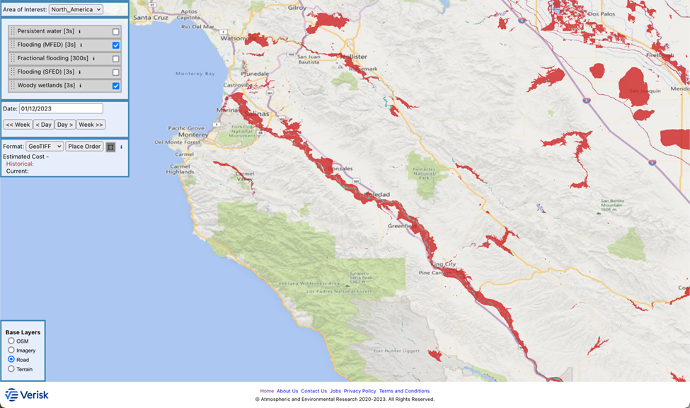
Image 1: FloodScan Maximum Daily Flood Extent Depiction (MFED) product for January 12.
The FloodScan map in image 1 (above) focuses on flooding on the Salinas River, which threatens to cut off access to parts of central California’s Monterey Peninsula [2]. Image 2 (below) shows a wider view, which includes flooding throughout the Central Valley and into Nevada.
FloodScan automatically maps large-scale inland flooding across North America, Africa, and South America from cloud-penetrating passive microwave satellite observations. Flood maps are updated daily as long as rain-free skies allow signals from the ground to reach the satellites. FloodScan typically won’t map small scale or short-lived flash floods that are harder to reliably detect from passive microwave satellite sensors.
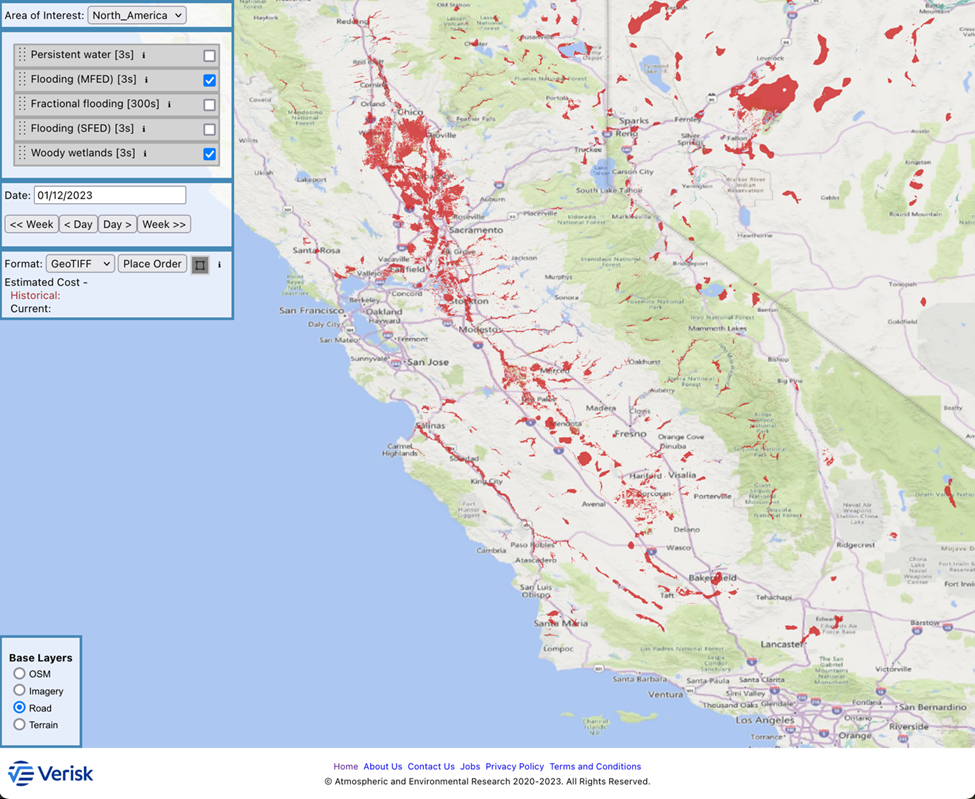
Image 2: FloodScan Maximum Daily Flood Extent Depiction (MFED) product for January 12.
[1] https://www.nytimes.com/2023/01/04/us/california-storm-weather-forecast.html
[2] https://www.washingtonpost.com/weather/2023/01/12/california-monterey-peninsula-river-flooding/