Atmospheric and Environmental Research (AER) continues to be an integral participant in the world's most advanced weather satellite programs. We work with government and industry satellite/instrument teams to develop new ways to improve the science, speed and accuracy of space, solar and Earth-based weather data gathering, analysis and forecasting.
The key is our experience with advanced remote sensing techniques combined with our software development expertise. Our software takes raw satellite data and transforms it into actionable intelligence. By deriving detailed meaning and clarity from new instrument technologies, we have improved weather forecasting, severe storm tracking for hurricanes and understanding of the Earth’s climate and advanced meteorological research.
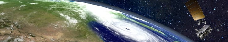
GOES-R (Geostationary Operational Environmental Satellite) Series Ground Segment
AER plays a major role in the development of NOAA's next generation geosynchronous satellite series, GOES-R.
The National Oceanographic and Atmospheric Administration (NOAA) operates satellite constellations used to measure crucial atmospheric quantities necessary for accurate numerical weather prediction. NOAA's Geostationary Operational Environmental Satellite – Series R (GOES-R) is the latest generation of geostationary weather satellites, which feature dramatic increases in image resolution, refresh rates, and spectral coverage, resulting in improved meteorological and environmental information.
The first of four planned GOES-R series satellites launched in November 2016 and operationally serves as GOES-16/GOES-East. The second satellite launched in March 2018 and operationally serves as GOES-17/GOES-West. The launches of GOES-S and GOES-T will ensure system continuity through at least the mid-2030s.
Starting in 2009 as a key member of a team led by L3Harris Corporation, AER had a significant role in development of the GOES-R Ground Segment operational software. The Ground Segment receives and processes satellite data and generates and distributes weather data to thousands of users throughout the Western Hemisphere.
AER scientists and software engineers provided unique and expert capabilities in remote sensing, systems engineering, and software development that aided NOAA in its transition to the next generation of environmental products produced by the GOES-R system. AER led the transition of government-provided algorithm descriptions to scientifically validated software now fully integrated into the GOES-R system and continues to support NOAA’s use of the GOES-R ground system by providing on-site support in College Park, MD.
AER Accomplishments and Expertise
AER played crucial part during all phases of systems engineering and software development from initial planning to design, implementation, and formal testing and sell-off to NOAA with responsibilities in the domains of systems engineering, processing infrastructure, architecture design, modeling and simulation, and operations and maintenance.
AER built the operational algorithm software that produces the primary Level 1b calibrated instrument data and Level 2 environmental products using the down-linked data from the GOES-R suite of satellite-based remote sensing and in-situ sensors. AER developed the product monitoring and product performance software used in continuous performance evaluation of the sensors and their products. AER participated in the design of the GOES-R Rebroadcasting (GRB) subsystem. Finally, AER contributed significantly in defining GOES-R system architecture through the co-development of the GOES-R Data Model Interface (DMI) and Algorithm Framework for continued development and testing. (The Algorithm Workbench framework is available to support the entire algorithm life-cycle development.)
Overall, AER successfully implemented 40+ algorithms that provide calibrated imagery and data (Level 1b products) from the six GOES-R sensors, as well as data products from the GOES-R operational data (Level 2+ products). AER worked closely with lead algorithm scientists who developed the underlying scientific basis of each algorithm. AER engineers derived software-level requirements and coded 450,000 lines of operational and test software employing CMMI Level 3 software development and quality assurance processes. AER supported transition of these algorithms and products to 24/7/365 operations in the GOES-R Ground System.
With GOES-R Series and Ground System now operational, AER continues to aid L3Harris and NOAA in GOES-R sustainment efforts, including the support of ongoing algorithm improvements and systems testing ensuring that NOAA will be able to maintain the next-generation, state-of-the-art GOES system—a vital national asset—for years to come.
Learn more about the GOES-R Environmental Products.
Watch a video overview of the GOES-R operational mission.