Cyclone Idai hit southeastern Africa in mid-March with ferocious winds and heavy rains. The storm system that became Idai had its first effects in Malawi in early March, where it caused heavy flooding that displaced more than 82,700 people [1]. After going out to sea, the storm returned as a cyclone that bore down on Beira, Mozambique the night of March 14 to 15 [2]. The storm has since been called “one of the worst” weather-related disasters ever in the Southern Hemisphere [3], with parts of central Mozambique turned into an “inland ocean.” [4]
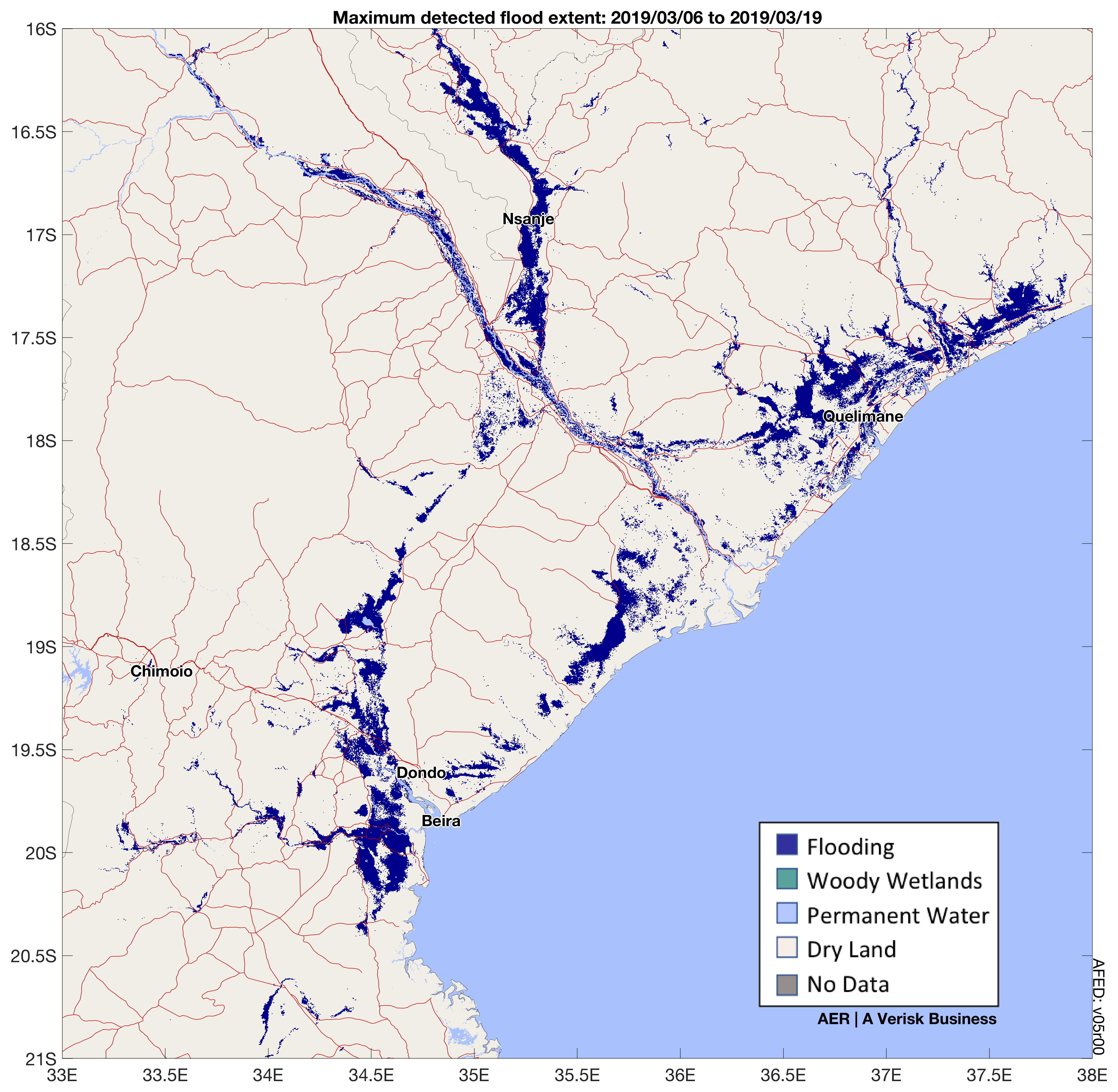
AER’s FloodScan system automatically maps large-scale river flooding daily across Africa and North and South America from cloud-penetrating passive microwave satellite observations. FloodScan first detected a rapid increase in flood extent on March 7 along the Shire River in southern Malawi followed by flooding in Mozambique along the Zambezi River and in its extensive coastal delta. By March 18, FloodScan detected and mapped the “inland ocean” that had formed northwest of the devastated coastal city of Beira. The image below shows the maximum flood extent detected by FloodScan between March 6 and 19.
AER operates FloodScan in Africa for the African Risk Capacity, a Specialized Agency of the African Union established to help African countries respond to natural disasters like this one through innovative financing mechanisms. In addition, we have been sharing flood maps in real time with the World Food Programme and others working on the front lines of disaster response in the region.
FloodScan uses data from the AMSR2 and GMI satellite instruments. GMI was designed and built by AER partner Ball Aerospace with whom we are currently working on a next-generation sensor for the Weather Satellite Follow-on – Microwave (WSF-M) satellite. If all goes as planned, FloodScan will incorporate WSF-M data after launch, continuing its record of daily flood mapping in Africa into the future.
For more information and access to a web-based interface to FloodScan’s automatic flood maps, visit floodscan.aer.com.
Footnotes:
[1] https://reliefweb.int/disaster/tc-2019-000021-moz
[2] https://www.unocha.org/southern-and-eastern-africa-rosea/cyclone-idai
[3] https://www.nytimes.com/2019/03/19/world/africa/cyclone-idai-mozambique.html
[4] https://www.nytimes.com/2019/03/19/world/africa/mozambique-cyclone.html
See other operational FloodScan events:


