
FloodScan's Maximum Daily Flood Extent Depiction (MFED) product for February 5, 2024
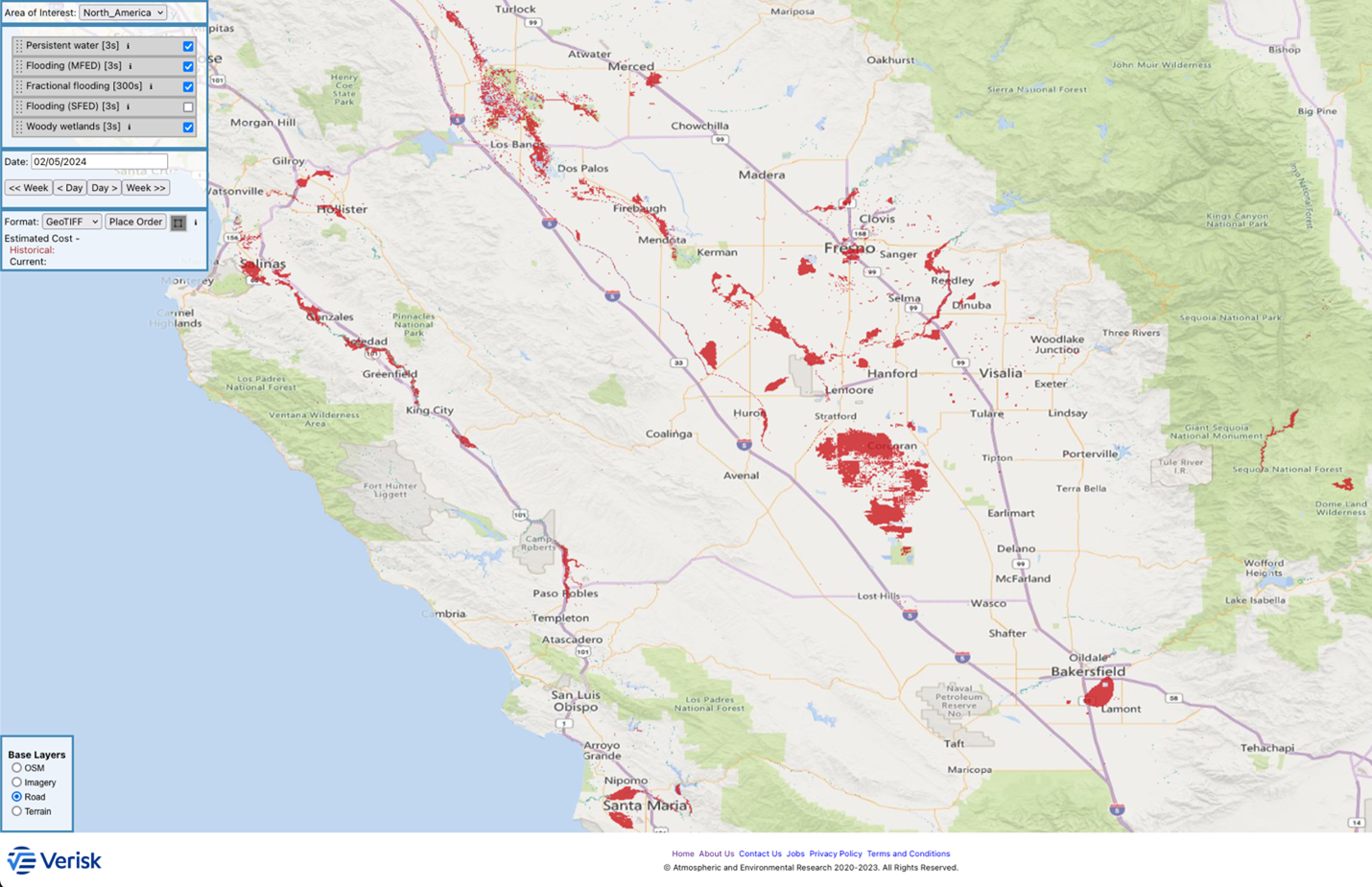
AER’s FloodScan began mapping California’s latest floods with satellite data recorded on February 5, 2024. This early look indicates extensive flooding in the Central Valley from the areas around Bakersfield north to Patterson, along the Salinas River from Paso Robles to Salinas, and around Santa Maria. So far only FloodScan’s maximum flood extent depiction (MFED) product has picked up flooding. MFED is more sensitive to flood signals than FloodScan’s standard flood extent depiction (SFED) but more likely to over-estimate flood extent. See the FloodScan Data Users Guide for guidance on selecting the best product for your needs.
FloodScan automatically maps large-scale inland flooding daily across North America, Africa, South America, Australia, and most of Asia from passive microwave satellite data. Microwave sensors allow FloodScan to detect flooding through clouds day or night, increasing the chance that a FloodScan will map a flood’s largest extent. Flood maps are updated when rain-free skies allow signals from the ground to reach the satellites. FloodScan typically won’t map small scale or short-lived flash floods that are harder to reliably detect with passive microwave satellites.
Rain continued to fall in much of southern California on February 5th and 6th, increasing the likelihood of flooding while also obscuring the surface for microwave satellites. We expect FloodScan to map more flooding in over the coming days after rains subside.
Anyone is free to use the FloodScan data browser to view flood maps and place orders for GIS-compatible GeoTiff files of FloodScan’s products. FloodScan data browser registration requires only a valid email address.